
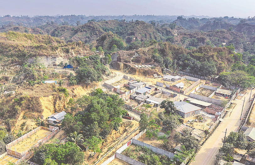
Hills are being carved into residential plots and vital water bodies are being filled to make way for concrete structures. Over the past four decades, the port city of Chittagong has lost a staggering 3,000 reservoirs. Official records show that 130 legal cases have been filed over the last 23 years in connection with illegal hill cutting. Concurrently, the average land surface temperature across the district has risen by nearly 1.8 degrees Celsius over a span of 13 years.
Upon visiting the Arefin Nagar area in Chittagong city in search of hills, one is instead greeted by an overwhelming expanse of residential housing. Hundreds of homes nestle within the folds of the hills. Slopes have been leveled to create ground for building, corrugated tin houses cling to fractured hill faces, and makeshift roads have been carved directly through the topography.

Recent visits to the area reveal that settlements continue to expand aggressively through unchecked hill cutting. In some sections, hill slopes remain dangerously steep and precipitous, while elsewhere, earth has been systematically excavated in tiers to clear ground for construction, flanked closely by older settlements. This dramatic transformation of the landscape is also starkly evident in satellite imagery.
Recent research indicates that between 2011 and 2024, the average land surface temperature in Chittagong district increased by nearly 1.8 degrees Celsius. While the average surface temperature stood at 32.48 degrees Celsius in 2011, it climbed to 34.27 degrees Celsius by 2024.
It is important to note that this metric differs from the atmospheric air temperature measured by the Department of Meteorology. Land surface temperature refers to the radiative heat of the Earth's surface—how hot asphalt roads, building rooftops, bare soil, grass-covered fields, or other physical surfaces become when exposed to direct sunlight.
This upward trend in temperature is not merely a recent phenomenon; it reflects a long-term degradation of land use patterns across Chittagong. Hills have been sliced away, ponds and traditional water tanks filled up, and green cover systematically depleted. In sharp contrast, concrete buildings, asphalt roads, and other paved infrastructure have proliferated. Researchers point out that areas retaining natural hills, vegetation, and water bodies maintain significantly cooler surface temperatures, whereas zones dominated by concrete and pavement trap and radiate intense heat.
Over the past two decades, urban water bodies in the city have shrunk by 20.51 percent, compounding the environmental vulnerability of the region.